Urban geography course shows students there’s more to Grand Rapids than meets the eye
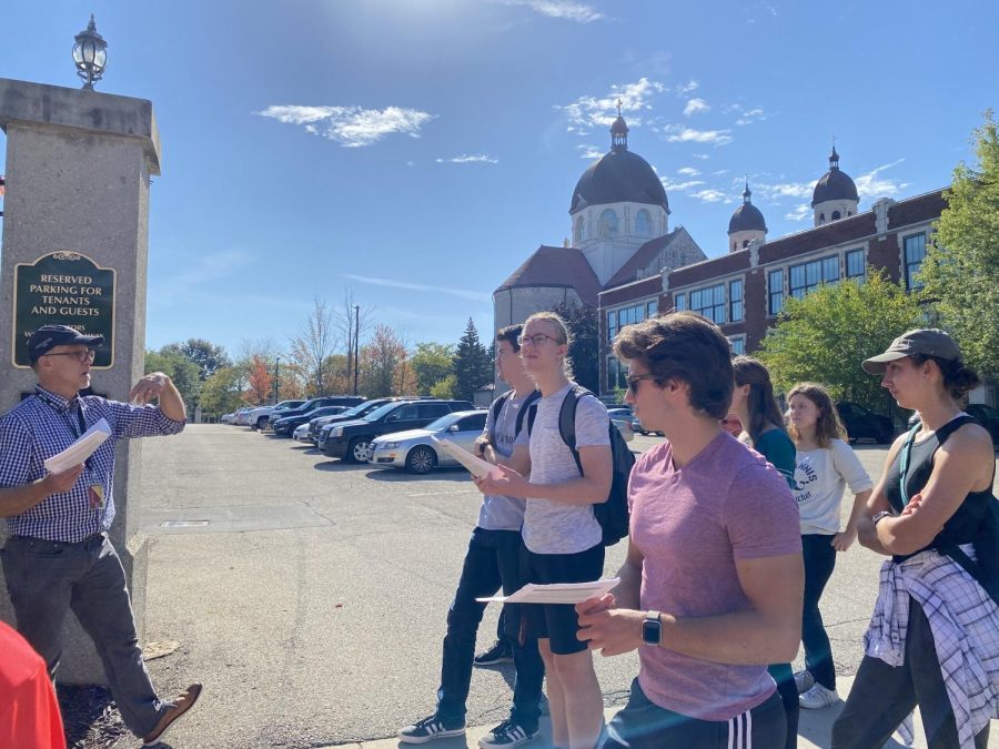
The Basilica of St. Adalbert, pictured in the back, is one of the sites where Geo 310 students meet to learn about the city.
A 15-minute drive away from Calvin’s secluded campus, two dozen students and a veteran professor pile out of three large vans. They emerge in the shadow of the towering Basilica of St. Adalbert, which has stood watch over its quiet downtown neighborhood for over a hundred years. Once everyone’s gathered, the professor begins teaching, but instead of a PowerPoint and whiteboard, the buildings and streets are his teaching tools. Armed with paper handouts full of class material, the students listen and ask questions as Professor Mark Bjelland leads class in the heart of the city.
On each corner, a building or street example brings course content to life. Three church buildings with corresponding schools in adjacent neighborhoods demonstrate the territorial nature of parishes in the late 1900s. An old high school-turned-apartment-building highlights how old buildings are being repurposed today, the appealing arches over each window showcasing the pride that communities took in the appearance of their shared spaces.
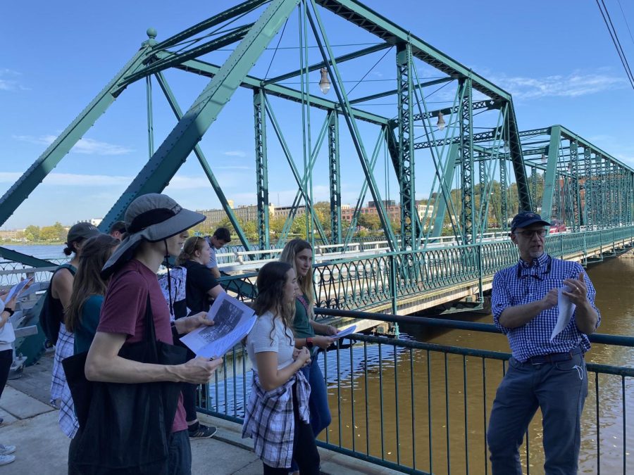
Bjelland’s “Urban Geography” class (Geo 310) meets for 50 minutes on Mondays, Wednesdays and Fridays, but students also get to experience an additional, three-hour lab session on Wednesday afternoons in which they visit different parts of Grand Rapids.
Junior Addison Arendt said the course is “one of my favorite classes I have taken at Calvin … Every week is engaging and focuses on new topics and ideas.”
The urban geography course was originally developed by Professor Henk Aay, who constructed a set of course materials about Grand Rapids and took students around the city while teaching the class. Later, Professor Jason Van Horn added a geographic information systems component to the class, leading GIS exercises in the classroom while Aay took students on field trips in Grand Rapids.
Bjelland took over the class when he came to Calvin in 2013. During his first year teaching the class, Bjelland was learning right alongside the students.
“I moved [to Grand Rapids] on Aug.ust 17, and then started teaching at the beginning of September,” said Bjelland, who had only briefly visited Grand Rapids previously. Suddenly the leader of a three-hour lab exploring the city, Bjelland had to do some quick learning and planning. Fortunately, he was able to lean on the course materials that Aay had developed, along with his own experience living in the cities of Minneapolis, Vancouver and Seattle.
Still, teaching the class required considerable on-the-go preparation. “I was usually driving around or riding the bus or walking around late Tuesday night practicing for my Wednesday labs, at first,” said Bjelland.
Bjelland’s work in the years since has continued to develop a course that’s dedicated to showing students real-world examples of in-class content.
“I think [the lab and lecture] fit like a hand and glove,” Bjelland said. “They really work together.”
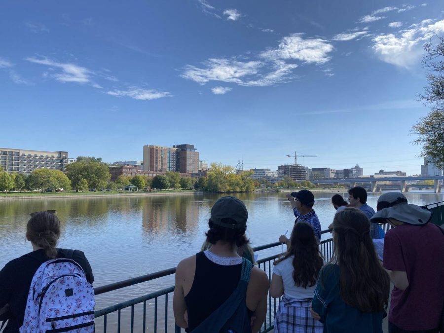
In a recent example, Bjelland and his students went from talking about education and healthcare as important factors in downtown spaces to visiting Medical Mile and Grand Valley State University’s downtown campus, witnessing the housing and economic expansion that’s come as a result.
“This experience [of exploring Grand Rapids] turns the whiteboard into reality,” said Arendt. “Seeing the city up close helps me understand concepts that we have talked about in class.”
During most lab sessions, the group commutes to a new Grand Rapids neighborhood, where they walk, bike or drive around the area, frequently stopping to examine urban features.
Over the course of the semester, Bjelland works with a number of Grand Rapids agencies that host lab sessions, including Habitat for Humanity, Inner City Christian Federation, the Ada Downtown Development Authority, Grand Rapids Black Businesses, Neighborhood Ventures and the Alpine Township planning department.
Last year, the COVID-19 pandemic forced Bjelland to get creative with the course, especially when it came to travelling from Calvin to different Grand Rapids locations. Historically, the class has used a couple of vans as its predominant means of transportation, but Bjelland turned to public transit and bicycles to allow for better social distancing. Over the course of the semester, Bjelland and his students biked over 75 miles.
This year, as social distancing guidelines lightened up, Bjelland chose to incorporate the best parts of his social distancing plan into the course permanently, adding two walking labs and one biking lab.
A number of students from the class have gone on to careers in city planning in places like Ypsilanti, Chicago and Seattle, with several now in leadership positions.
For all students, the course is an opportunity to see the city in which they live and learn in a different light — even if they’ve had considerable experience with parts of the city already.
“I grew up in the Grand Rapids area and we have been to so many places I have never been in all the years I have lived here,” said Arendt.
This experience isn’t unique, according to Bjelland. “We go places that most Calvin students never go,” he said.
“A lot of students never ride public transit. A lot of students never really get far from campus,” Bjelland added. “We tend to be kind of isolated in our corner of the region over here.”
With each lab session and each passing semester, Bjelland bridges the gap between Calvin and other Grand Rapids communities, showing students there’s more to the city than they might think.



Bjelland Janice • Nov 11, 2021 at 2:32 pm
Congratulations to my son, Mark Bjelland, the veteran professor of Urban Studies at Calvin U. You grew up in the Ciity (Minneapolis) and developed a love for history of cities as well as a love for nature in the wild. I loved this story, well written.