


Geo prof predicts Irma’s potential damage
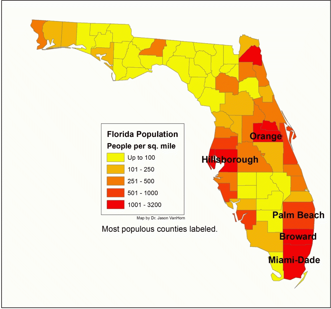
Photo courtesy calvin.edu.
Geography Professor Jason VanHorn tracked the path of Hurricane Irma to uncover how many people were in the storm’s path this week. Though VanHorn’s technologically-based research revealed an alarming amount of people in the path of the storm, he was grateful and relieved that around a third of the population of the state of Florida evacuated. He believes the results would’ve been much more catastrophic if it wasn’t for Florida’s successful planning and response.
“We haven’t had two category four hurricanes in one year hit the US coast,” VanHorn said. Following the destruction of hurricane Harvey, the seriousness of hurricane Irma provoked VanHorn’s research.
Technology was central to the entire research process. VanHorn noted that this research would have been impossible without the modern technology that enables it, particularly satellites and GIS (Geographical Information Systems). GIS can be used for both computer mapping and analyzation of spatial phenomena.
Though he personally used GIS in his research, we wouldn’t have even been aware of an incoming hurricane if it wasn’t for advanced satellites used in this area of research.
Using state of Florida census data, VanHorn used GIS to develop a 10-mile boundary along the coast, allowing him to calculate the number of those in harm’s way.
VanHorn says that geographers and other researchers will have to answer whether these recent storms are simply a coincidence or part of a larger meteorological trend.
While future questions might be pertinent, Vanhorn doesn’t foresee his future research to focus on hurricanes, though it is possible.
VanHorn’s research primarily consists of terrorism and homeland security, as well as interactive maps “to aid answers to questions about human interaction with space.”
For further reading, check out VanHorn’s research regarding hurricane Irma on Calvin’s website.